|
|
Kraggenburg, Netherlands, Europe |
|
|
|
|
|
|
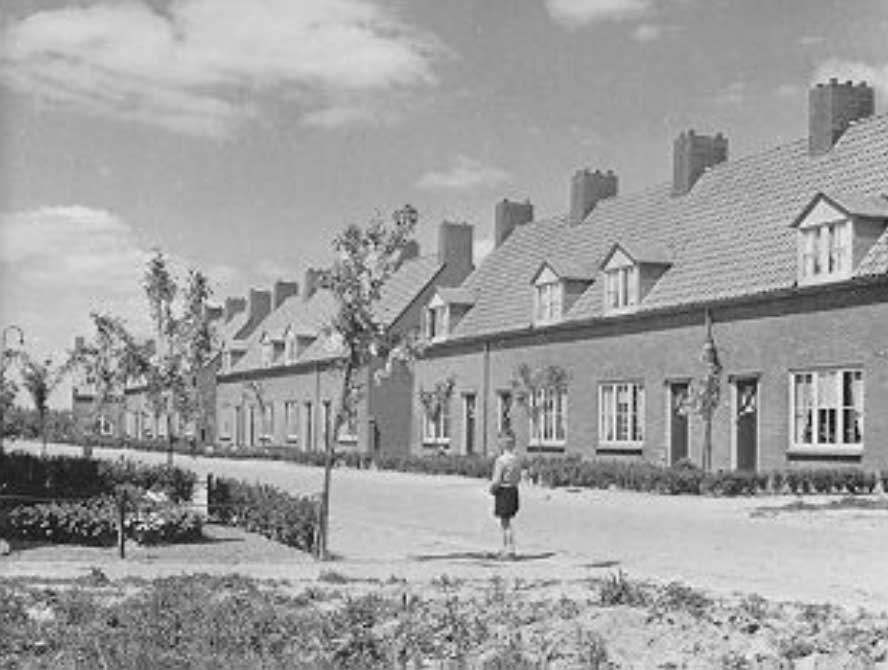
The Finsestraat from the
south, 30-5-1951
source: Directorate of the
Wieringermeer
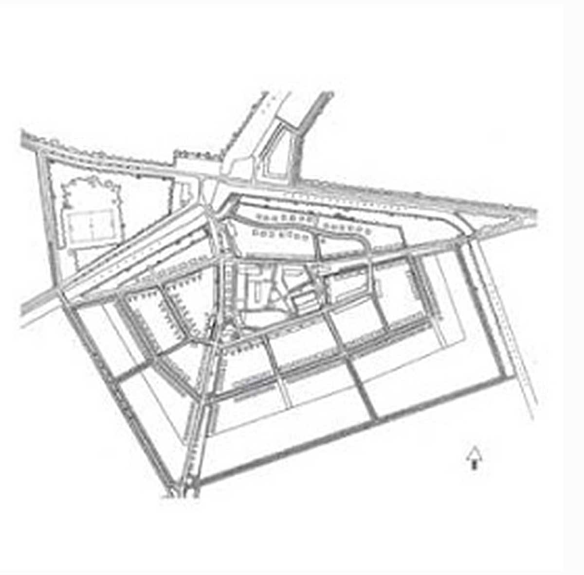
Final design by F.H.
Dingemans, 1949
source:
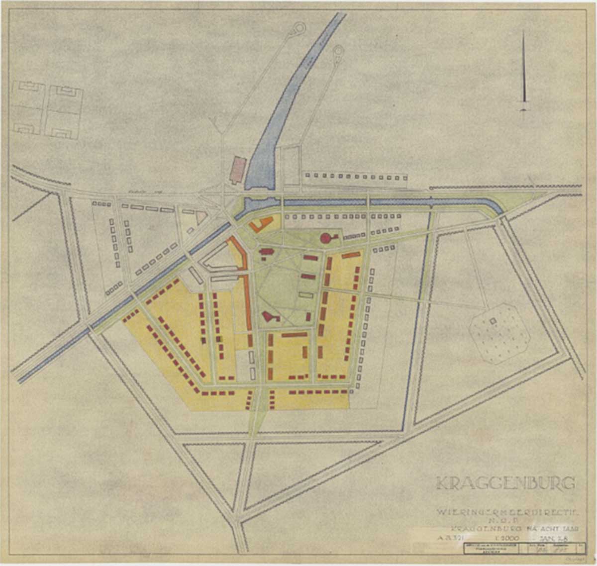
First phase: Central part
of Kraggenburg with
churches of different
denominations and first
housing, January 1948
source: Directorate of the
Wieringermeer
|
Kraggenburg is located in the Noordoostpolder, a polder that was reclaimed between 1937 and 1942 and previously was part of the Zuiderzee. With over 30 kilometers of dike, an agricultural area of 460 km2 was added to the Dutch soil. The reclamation was a consequence of the Zuiderzee Act of 1918. Food supply had been elevated to a political priority after World War I and the economic crisis of the 1930s.
After the end of World War II, parcels of land in the Noordoostpolder were issued in 1947 to strictly selected farmers, mainly from the north of the country.
The design of the polder is based on the Central PLace Theory (1933) of German geographer Walter Christaller (1893-1969). He was the first to look at cities as a system in which smaller and larger cities form a network in relation to each other. He distinguished between A, B and C cities: small settlements, larger cities and regional centers.
Centrally located in the Noordoostpolder is the ‘capital’ Emmeloord, a city of the B-category. Around it, in a circle, are 10 villages of the A-category: Marknesse, Ens, Tollebeek, Luttelgeest, Nagele, Rutten, Creil, Kraggenburg, Espel and Bant. The later built Lelystad was meant as a city of the C-category. The two historic islands of Schokland and Urk became part of the polder through reclamation.
Kraggenburg sits close to the eastern border of the province of Flevoland. It lays in between the villages of Marknesse to the north and Ens to the west. The name Kraggenburg is derived from a small harbour that was located in proximity of this location, at the end of long breakwaters, that had to prevent the nearby river Zwolse Diep from flooding.
This small harbour would eventually form the basis for the current village. Following the land-reclamation project in 1942 which resulted in the Noordoostpolder, the old harbour became isolated from the sea and the development of Kraggenburg accelerated. Kraggenburg became the first village in the newly created polder that was not being designed by the Directie Wieringermeer – the governmental body responsible for the spatial development of the polder. Instead, the spatial lay-out of the village was designed by the architect Piet Dingemans who followed the ideas of the influential Delft School, following traditional ideas about the meaning and style of architecture, in opposition with modernism.
Demographically, the village slowly began to change in 1960s when the upcoming aviation and waterwork industry attracted a highly educated and well-paid work force. This led to an increase in demand for luxurious homes and sufficient public amenities.
More recently, the development plans by the provincial and municipal government point towards a more recreational character for the village. Already, the village contains several accommodations facilitating tourism and the expectations are that the growing neighbouring forest will prove to be a valuable asset.
source: INTI |
|
2008 - 2024 disclaimer
|

)
)
)