|
|
Westervoort, Netherlands, Europe |
|
|
|
|
|
|
|

In 1965-1966 was the first mentioning of the 'tweede nota ruimtelijke ordening' by the 'Tweede Kamer'. In this notition the development of the third city wing of the city of Arnhem is subscribed. Between 1974 and 1978 there is a sequence of meetings with the town of Westervoort, province Gelderland and ministry van VROM about the future status of the centre for urban development. On may 15th 1981 the minister of VROM points out Westervoort and Duiven as a centre of urban development.
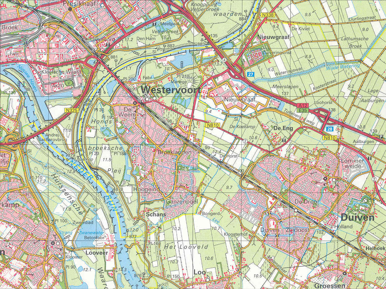
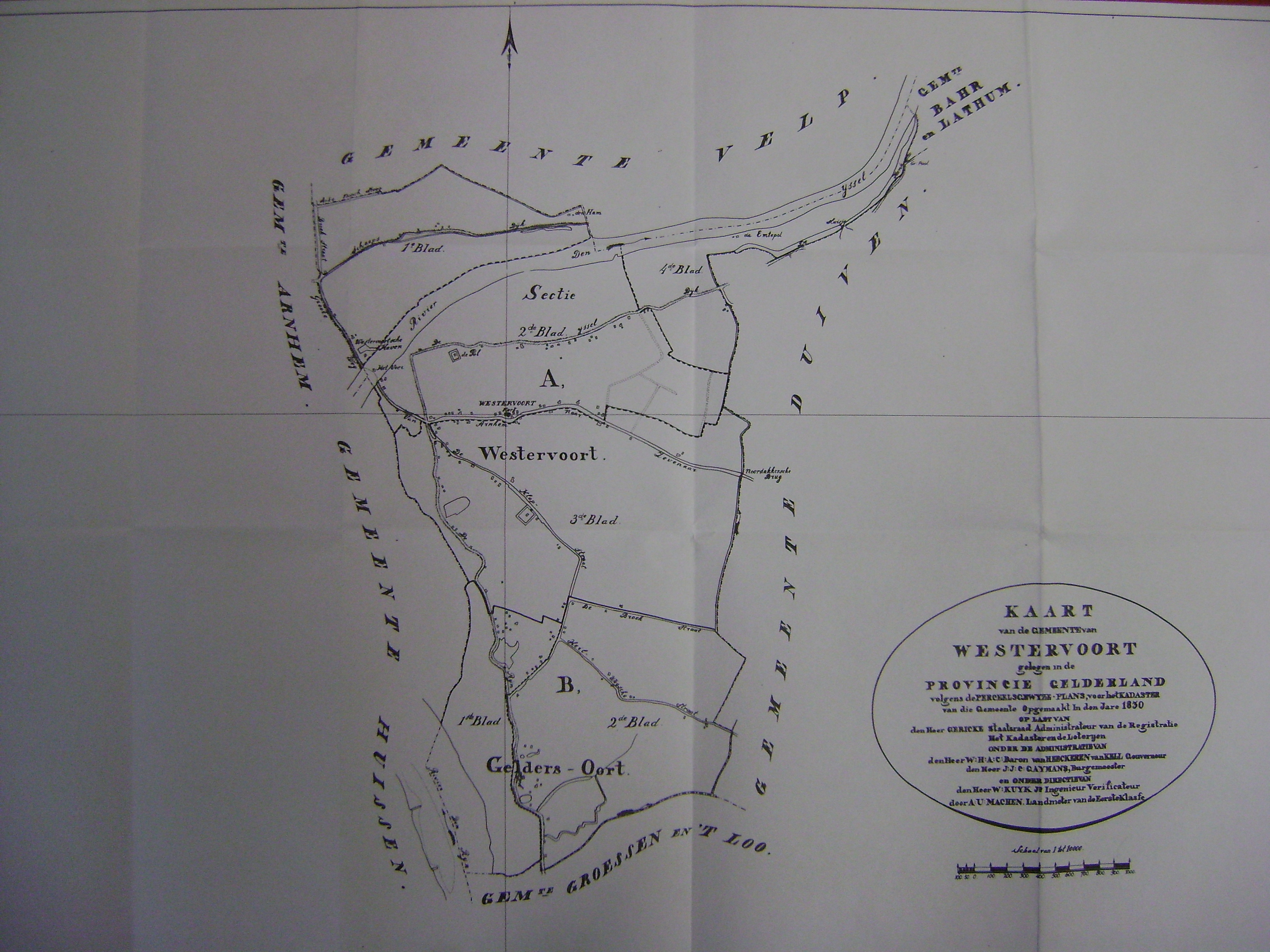
The first time Westervoort was mentioned, was in a scription of the important missionairy Werenfridus in 726. The town is located in the province Gelderland right under its capital city Arnhem, between the rivers IJssel and Rijn. Its name refers to a shallow crossing in the river, giving access to the west. The land lay under rule of the Lord of Bergh, but her rights were bought by Arnhem in 1735.
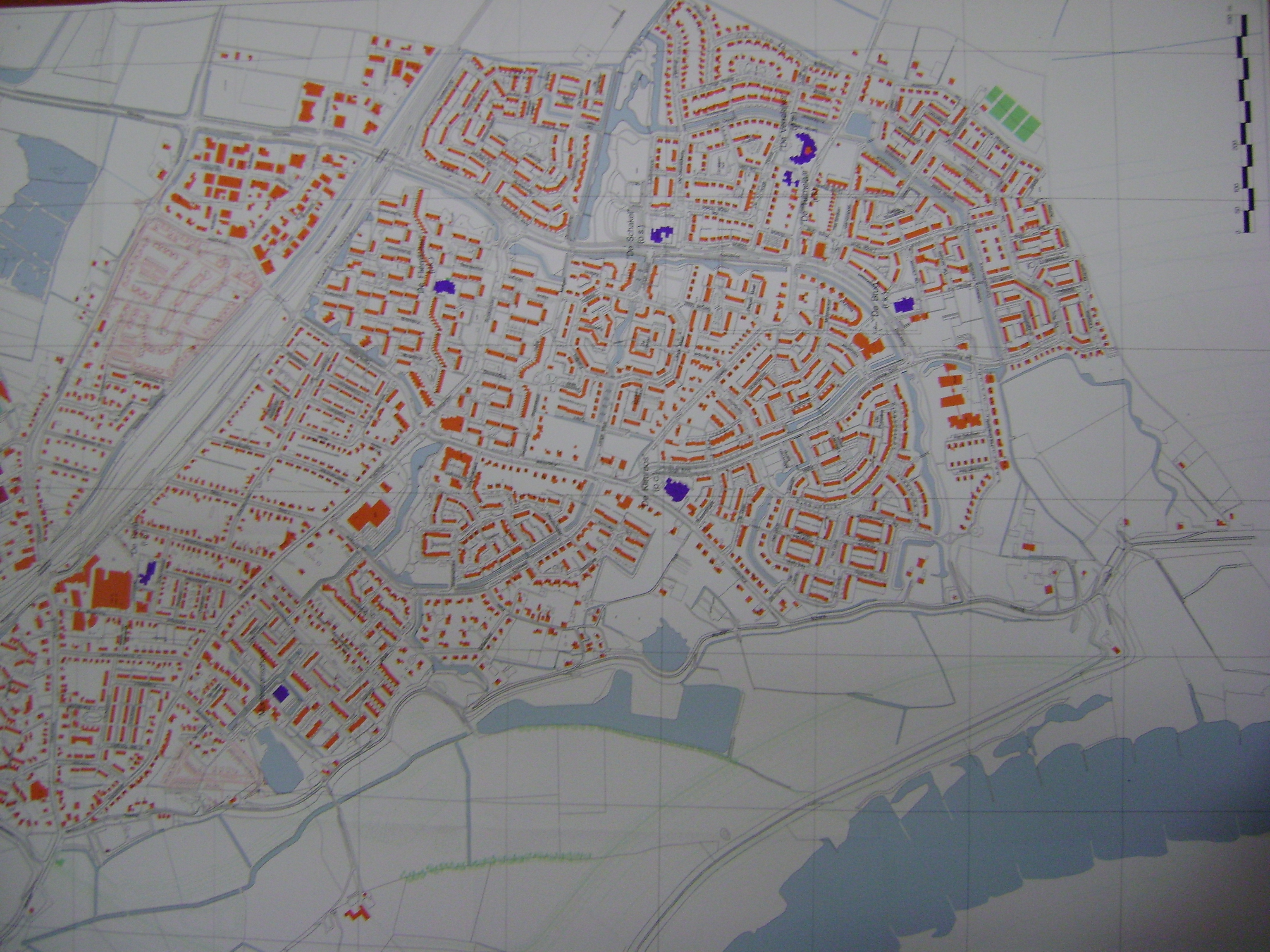
In 1981 the ministery of VROM (volkshuisvesting, ruimtelijke ordening en milieu) pointed out Westervoort and its neighbour town Duiven, as a centre for urban development to help solving the housing problems in Holland. Between 1981 and 1995 nearly 9000 houses were build and the population grew from 5.351 in 1975 to 15.372 now.
An important subject in town history is water. Though the rivers around the town flooded several times, leaving the citizens in despair, men battled water and build dikes to protect the town. Another important moment in history was the commence of World War II in Holland on the 10th of May 1940, by blowing up the IJsselbrug to hold of the german invaders.
Westervoort has a rich history of water, war and growth and is now a steady town between the two important cities, Arnhem and Nijmegen.
source: |
|
2008 - 2024 disclaimer
|
