- A. Reijndorp, Like Bijlsma, Ivan Nio. Atlas Nieuwe Steden. De verstedelijking van de groeikernen, Haarlem/Rotterdam: trancity*valiz, 2012.
- A. Faludi, A.J. van der Valk, De groeikernen als hoekstenen van de Nederlandse ruimtelijke planningsdoctrine, Assen/Maastricht: Van Gorcum, 1990.
- Niek de Boer, Donald Lambert. Woonwijken: Nederlandse stedenbouw 1945-1985. Rotterdam: Uitgeverij 010, 1987.
- Martien de Vletter. De kritiese jaren zeventig, architectuur en stedenbouw in Nederland 1968-1982. Rotterdam: Uitgeverij 010, 2004.
- W.J. Pantus. Groeikernen in Nederland: Een studie naar stedenbouw en architectuur, Utrecht: Stichting Matrijs, 2012.
type of New Town:
> scale of autonomy
New-Town-in-Town
Satellite
New Town
Company Town
> client
Private Corporation
Public Corporation
> policy
Capital
Decentralization
Industrialization
Resettlement
Economic
Context of its foundation
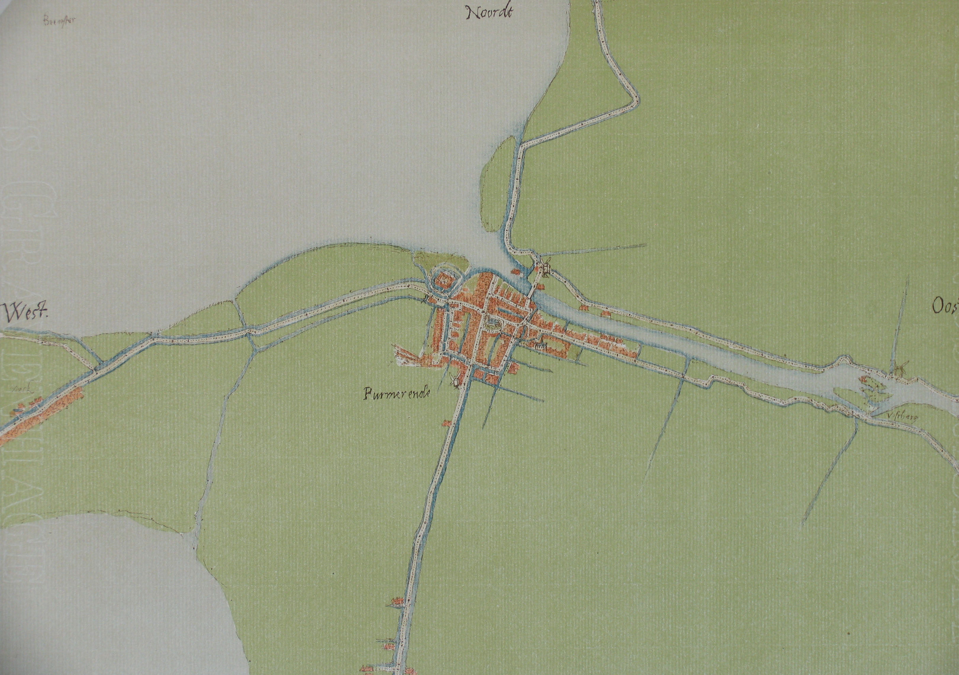
Purmerend, a city with a population around 73000 inhabitants, started as a village called Pumer, which was situated by the Beemster lake. Purmerend was built on favourable soil: the south bank of the small Weere river, which used to connect the former Purmer lake and Beemster lake. Around 1410 the villages Purmer and Purmerland became a seigniorial: an area in which a lord - the seignior - had certain powers of jurisdiction and administration.
The seignior was William VI, Count of Holland. He gave the seigniorial to a rich banker from Amsterdam, Willem Eggert, in return for the financial assistance he had received. Willem Eggart is also the founder of the city, who build a castle called Purmersteyn. The castle, which dominated the Purmerend skyline, was later demolished in 1741.
Initial developments
Until the 18th century the town was ruled by several seigniors, including several generals and other delegates during the French suppression. The political organisation was in hands of the 5 most wealthiest men.
In the 15th century Purmerend was granted an urban charter and under the successive seigniors trade and fishing, mainly for eel, brought prosperity to the town. An important event in the town's history was the granting of a market privilege. Jan van Egmond granted the town the right to hold two annual fairs and a weekly market, as from 14 April 1484.
Until 1612 the city's territorial kept its size, but the amount of inhabitants grew considerably. After the draining of the Beemster lake, which was a familiar thing in Holland at that time, the ability to expand the city was now available.
The draining of the Beemster lake in 1612 and the Purmer lake in 1622 meant a great loss in fishing grounds to Purmerend. However, the new and fertile soil favoured agriculture and livestock breeding, making Purmerend prosperous again. Purmerend now became the centre of an agricultural region, the produce of which was sold on the markets of Purmerend.
Biography of the town
First, the south east side of the lake was used for expanding the city. The rest of the land was used for the agricultural industry. In the middle of the polder, several counties where founded like: Edam, Beemster and the Schermer.
During the golden age of Holland, with the domination of the V.O.C., Hollan's capital Amsterdam was an interesting city to settle. Because of the employment in the agricultural sector, Purmerend had a steady population number.
In 1819 the government started building the Noord-Hollands canal to improve the connection between Amsterdam and Hoorn. The two harbours were the main economical sources of Noord-Holland. In 1884 a railway was build to connect Hoorn and Zaandam. Because of the growth of the industrial sector Purmerend became a city for farmers and other employees in the agricultural sector.
Modernisation of Purmerend
After the industrial revolution and WO II, Purmerend became a suburban city for Amsterdam. This was also the time when the government started to improve the infrastructure. First there was the auto speedway between Hoorn and Amsterdam which later became the highway A7.
Until the '60 the population number was around 10.000. In the next 30 to 40 years the population number grew over 70.000 inhabitants. The first planned district was Overwhere (built between 1958 and 1969) which is situated at the north side of the city. It was the first post-war district of Purmerend. After Overwhere the districts Wheermolen (1966 - 1972), Gors (1981 - 1987), Purmer Noord (1981 - 1990), Purmer Zuid (1987 - 1998) and Weidervenne (1996 - present) were build.
Anno 2008 Purmerend is an city of approx. 78.000 inhabitants with its own social and industrial facilities. It is a main suburban city for Amsterdam, next to Zaandam, Almere and Hoofddorp. Its history now lives in the Willem Eggart mall and Jan van Egmond college. The city also has its own hospital, cinema, museum, golf complex and swimming pools.